Coast to Coast Path: St Bees to Robin Hood's Bay
About this trip.
Comparing firms? Every Coast to Coast holiday on Mooch, side by side.
Before you book: Walking holidays vs cycling holidays — when each one is the right answer · Which Camino route is right for you — an honest opinion on each of the seven
From St Bees to the Lake District fells
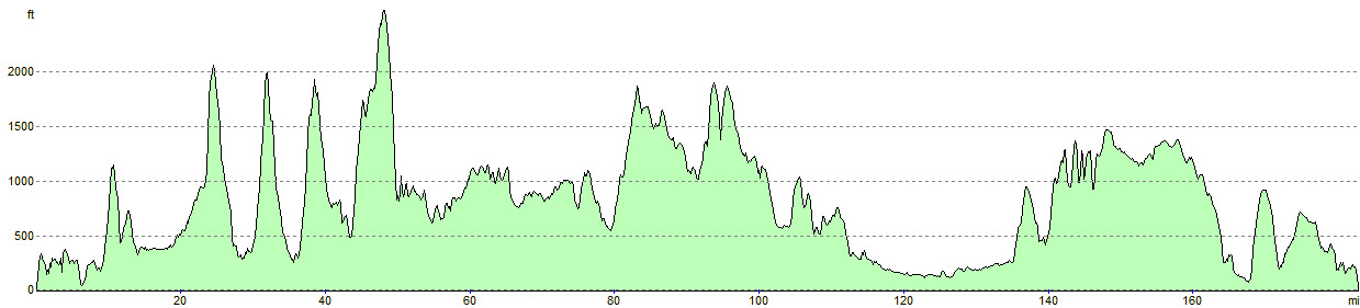
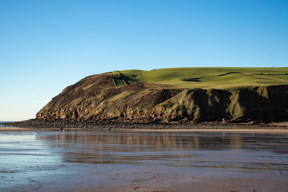
St Bees sits on the shores of the Irish Sea, and this itinerary walks the whole Coast to Coast route from there in 12 days. It is the shortest of the full-length versions. The longest day is 23 miles and no day is shorter than 11, so you need a good level of fitness. From St Bees the path climbs the sandstone cliffs of the headland, then turns inland over farmland and foothills to Ennerdale Bridge, where the Lake District begins. It runs up Ennerdale beneath Pillar Rock and climbs to Brandreth, with views of Great Gable and the Buttermere valley, before dropping into Borrowdale via Honister.
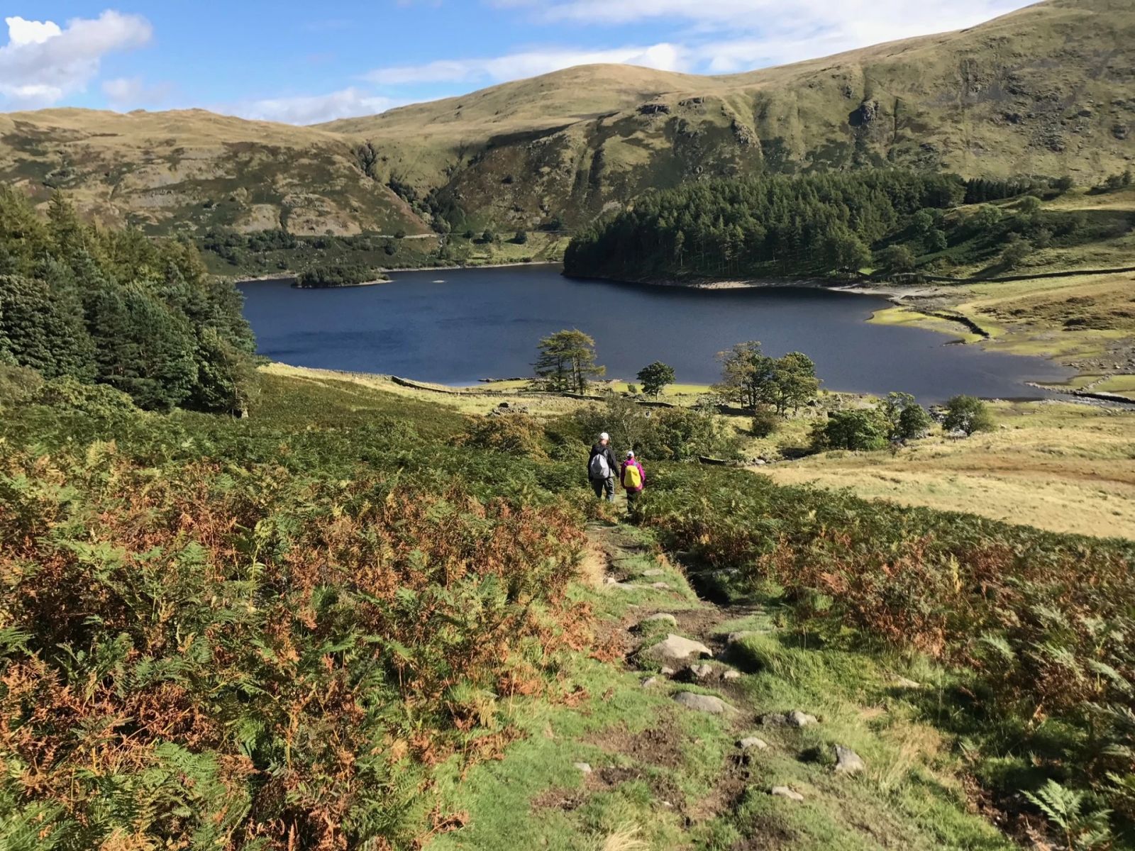
The next stage climbs up remote Greenup Gill, then comes down to Grasmere, either through the valley of Far Easedale or over the Lion and the Lamb, with Lakeland fells in view all round. From Grasmere you cross the pass at Grisedale Tarn, or go over the summit of Helvellyn, England's third highest mountain, and descend to Patterdale on the shore of Ullswater. The remotest walking of the route follows, over Kidsty Pike and down to Haweswater and on to Shap.
Limestone, moorland and the Yorkshire Dales
After the Lakes, the walk from Shap to Kirkby Stephen is undulating rather than mountainous. It follows limestone scarps and moorland paths through Orton and past many prehistoric sites. Beyond Kirkby Stephen the route climbs to Nine Standards, high above the Eden valley, and goes on into Swaledale, one of the longest and quietest parts of the Yorkshire Dales. Here you cross open moorland marked by drystone walls and field barns, with stretches of riverside path through the farming villages of Keld and Reeth. Near Richmond the moors give way to woodland. Richmond is the largest town on the route, with a cobbled market place below its castle, first built in the 11th century, and it's worth a day off.
The Vale of Mowbray and the North York Moors
After Richmond comes the only long low-level stretch of the route. It crosses the farmland of the Vale of Mowbray, often on country lanes. The North York Moors begin at Ingleby Arncliffe, where the path climbs through woodland and follows the steep northern edge of the moors, with wide views north over gritstone outcrops and grouse moor. After Great Broughton/Urra the last big climb takes you up to Urra Moor and round the head of Farndale. From there the long descent to the coast begins. The route follows the River Esk from Glaisdale to Egton Bridge and Grosmont, which many people think are the prettiest villages on the walk. It then passes through Littlebeck and its woodland and crosses farmland to the sea cliffs. These lead south to Robin Hood's Bay, a fishing village known for its narrow, steep streets.
Terrain, navigation and weather
Most of the walk is on clear paths, tracks and lanes, but some sections are muddy, wet, rough or steep. Expect a lot of ascent and descent in the Lake District, and the first half is the harder one. Work on the Coast to Coast Path National Trail is improving the signposting, and the route is due to be fully signed once that work is complete in 2026. Even so, the weather can turn quickly, even in summer, so you need to be able to navigate. Comfortable footwear and reliable waterproofs are essential. Thousands of ordinary walkers finish the route every year with reasonable fitness, the right kit and common sense.
The shape of the trip.
Everything you might be wondering.
Q1How hard is it really?
The grading is set by the operator and usually reflects daily distance and total ascent. As a rule of thumb: if you can comfortably manage a 5-6 hour hillwalk at home on a weekend, a moderate-graded route will be fine. Read the day-by-day notes carefully, and train with a loaded pack in the months before.
Q2Can I do this solo?
Yes — self-guided walking holidays are well suited to solo travellers, and some operators waive the single-room supplement on certain departures. The route notes are written for confident independent walkers, and most operators run a 24/7 support line.
Q3Do I need to speak the language?
No. Hotels and restaurants on the route are used to English-speaking walkers. A phrasebook for menus and a few polite basics (hello, thank you, please) is all you really need. The operator's support line speaks English.
Q4Can I bring my dog?
Some routes are dog-friendly, others aren't — it depends on whether all the accommodation on the itinerary accepts dogs. Check with the operator before booking. If you do bring a dog, you'll need a pet passport, up-to-date rabies vaccination, and a lead for villages.
Q5What if it rains?
The route is walkable in rain — your luggage travels ahead regardless, so you'll always arrive somewhere dry. Some trails get slippery in wet weather and the operator's support line can arrange a taxi for any stage if conditions are properly bad.
Q6How do I get there from the UK?
Most routes are reachable by a short flight to a nearby airport, followed by train or transfer. The operator will usually point you at the nearest airport and can advise on rail connections. Some will book train tickets on your behalf for a small fee.
Q7Can I shorten or extend it?
Usually yes. Many operators offer shorter versions of a route as a standalone, and most will add extra nights at the start or end at their own rates. Ask when you enquire — they'll tailor it before booking.
Q8What about cancellation?
Typically a deposit (usually 20-25%) is taken at booking, with the balance due 8-10 weeks before departure. The operator's own terms apply — Mooch doesn't handle the booking or refunds. Travel insurance is strongly recommended.
Three walking holidays, side-by-side.
The two closest walking holidays on Mooch, both on the Coast to Coast. Prices are the operators' own, per person.